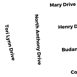
0013 HENRY DRIVE
Owner Information
PACHECO KAY I LIFE ESTATE
13 HENRY DRIVE
ACUSHNET, MA 02743


Property Details
0013 HENRY DRIVE is classified as a Single Family Residential (Ranch).
The primary structure on this property was built in 1965. There are 1,175ft2 of built area within this property. There is 1,175ft2 of residential/living space within this property. This property is listed as having 5 rooms.
0013 HENRY DRIVE is valued at $240,300. The land is valued at $96,200 and the structures are valued at $144,100.
The most recent deed for 0013 HENRY DRIVE is recorded at the local registrar in Book 11170, Page 201. 0013 HENRY DRIVE was last sold on Thursday, September 11, 2014 for $1.
Assessment data from fiscal year 2021.
Flood Data
According to the FEMA National Flood Hazard Layer, this property does not appear to be in a flood zone. It may also be in an area not yet reviewed. Nonetheless, confirm this information prior to taking any action.
To view the flood hazards around this property, create a FEMA "Firmette" Map of the area around 0013 HENRY DRIVE.
Broadband Internet Providers
| Provider | Type | Bandwidth (mbps) | |
|---|---|---|---|
| GCI Communication Corp. | Satellite | 0 | 0 |
| HughesNet | Satellite | 25 | 3 |
| VSAT Systems, LLC. | Satellite | 2 | 1 |
| Viasat Inc | Satellite | 100 | 3 |
| Verizon New England Inc. | DSL | 15 | 1 |
| Comcast | Cable | 1000 | 35 |
Broadband service provider data from December 2020.
Adjacent Properties
- 0011 HENRY DRIVE
Single Family Residential owned by AMARAL EDWARD S - 0014 NORTH ANTHONY DR
Single Family Residential owned by NICODEMISEN ROBERT F & ROBIN S TRUST - 0016 NORTH ANTHONY DR
Single Family Residential owned by SANTOS ANTONIO E & ANA M - 0014 MARY DRIVE
Single Family Residential owned by THOMAS JOSEPH P